Thursday, September 13, 2012

A Thru-Hiker's Closing Ceremony


We woke up, ate breakfast, and headed to the nice, hot showers again.  I had not washed my hair yesterday, although I was dying to, because I didn't want to get chilled.  It was still chilly this morning, but my plan was to wash my hair, and then go loiter in the camp store, drinking hot coffee, and letting my hair dry in there where it was warm.

The shower was divine, and the coffee was even more so.  The man in the store was very friendly, and I think he was happy to have some company.  He let me loiter all morning.  When the sun finally came up pretty good, I went and sat in it out under the canopy where we had all gathered the day before.  The sun felt so good.

As I was sitting there, I was watching a lady who was camping in a RV right down near the river by the bridge.  All of a sudden she grabbed her huge camera, and began running for the bridge.  I wasn't sure what she saw, but I wanted to see it also, so I ran for the bridge as well.  When I got up there, I ran to where she was, just in time to see her taking pictures of two beautiful bald eagles, just as they flew over the river, and right in front of Katahdin.  What a perfect morning this was shaping up to be!  We chatted a while.  They come here every year to camp.  Her husband fishes while she takes pictures.  Yesterday morning, she took a photo of a bull moose right across from where our tent was.  Too bad we missed that!

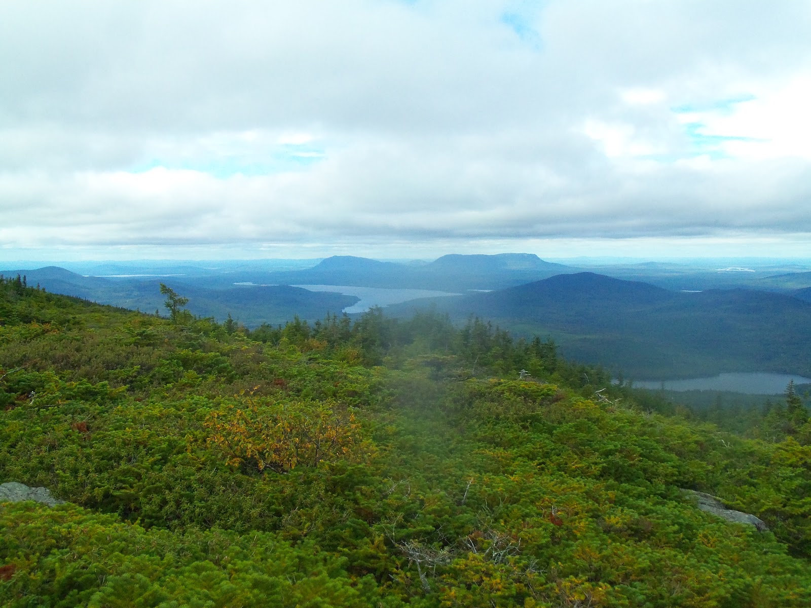
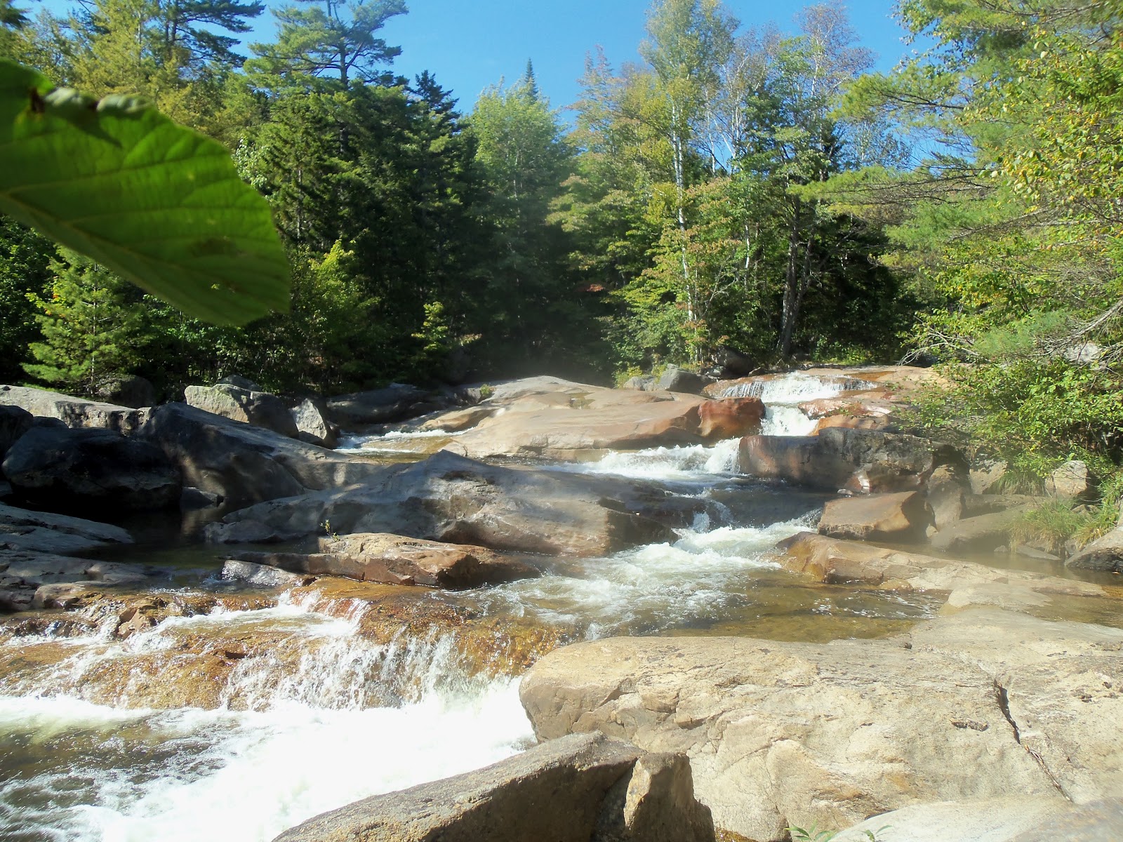
I was waiting until the restaurant opened at 11, because I was going to be first in line for a good, hot lunch.  Keith came over after he showered, and joined me in my vigil.  Soon, there were about 10 hikers waiting with us.  Everyone was going to eat lunch, and then hike on to Baxter State Park, which is where Katahdin is located.  After we ate, Dania and Swamprat showed up, and we loaded our packs into her car, and hit the trail.  The trail was particularly beautiful, following the Penobscot River for a ways, then stream after stream, then several waterfalls, and finally some beautiful ponds, right before we reached Katahdin Stream Campground, where we would be camping tonight.


When we reached the campground, Dania was there with coolers of beer and Coke, and she had snacks.  Other hikers joined us, and we had a little celebration.  Big Foot and Big Naranja were there, and they had summitted that day!  Huff and Puff also joined us.  They would summit tomorrow with us.  Later, Ninja Kindle walked up, and he had just come down from the top!  We then hiked over to the park office and registered with the ranger as thru-hikers.  Keith and I were number 413 and 414 northbounders for the year.  It was good to be official!  We were also invited to a celebration tonight at 7 at the Birches Campground.  We were told to bring a bottle cap and spork, and our book of matches we got in Georgia.  I told him we had never gotten a book of matches, so the ranger gave me one, and it said "Georgia Appalachian Mountain Club" on it.  We checked out the log book at the ranger station, and saw many familiar names that had already summitted - among them, Lighthouse, and Secrets and Shenanigans.

We found out that there was plenty of room for us to have our own shelter, and so we ended up camping just 2 shelters down from Huff and Puff, and everyone had plenty of room.  Dania and Swamprat headed back to their hotel in Millinocket, and at 7, we headed down to the Birches Campground with Huff and Puff.  There about 15 thru-hikers gathered at a nice campfire, and when the park ranger showed up, he brought two cakes, a container of peaches, and whipped cream.  Another hiker had brought a watermelon and strawberries. There was a section hiker there, named Bahama, who had been hiking the AT in sections since 2005, and tomorrow he would finish the whole thing.  All of the other hikers were all northbounders, like us, who were finishing their hikes tomorrow.  Bahama  brought a very nice bottle of rum, and asked everyone to get out their bottle caps, and we all used those for shot glasses to make a toast.  When the time came, the ranger asked those who had brought their books of matches to come forward, so we did, and we lit candles on the cakes.  As it turned out, we had never met this ranger in Georgia, but some of them had, and he had given them matches way back then, and asked them to bring them to Maine, and look for him.  He had planned to do this way back then!  The cake, topped with peaches and whipped cream, looked amazing.  The watermelon and strawberries were scrumptious, especially since fruit was something we never had on the trail!


It was just a really neat little closing ceremony for the whole AT trip.  It was a really great group of folks.  We had hiked with them all, at one time or another.  Some we had met as far south as Georgia, and some we had only met in the past few weeks.  We shared really great stories of our experiences, stories of other hikers along the way, and compared notes of where other hikers were.  Everyone hoped that Boots and Melody would come walking in.  We really did expect to summit with them, and wondered how close they were.  The hikers that were with us tonight were Kindle Ninja, Big Foot, Big Naranja, PJ's, Detour, Easy Rider, Huff and Puff, Bahama, Trekking Pole, Claudia Van Damme, Deep, Mr. Noodles, Hopper, and a few others.

The younger hikers were planning to get up at 2 in the morning, and head up the mountain, hoping to summit at sunrise, which would be at 6 a.m.  I couldn't imagine hiking up it in the dark!  But I'm sure the sunrise would be amazing. 

We made out way back to our shelter to get a good night's sleep.  We had planned to meet Swamprat and Dania at 7 in the morning to begin the hike up to Katahdin.  The weather was supposed to be PERFECT!

Wednesday, September 12, 2012

Out of the 100-Mile Wilderness!


After a really peaceful night, we woke up, and Keith slipped down to the pond very early, hoping to see a moose.  There had been moose droppings all over, so we hoped we would see one.  He did not have any luck, and came back pretty quickly.  I was amused, because as he came back up the hill from the pond, the red squirrels, who are very territorial, angrily chattered at him as he approached their section of the trail.  I heard them chatter the whole way, one after another, as he approached the tent.

We quickly ate and packed up, hoping to get an early start on this day, because we knew if we made good time, we could reach Abol Bridge Campground, which was the end of the Wilderness.  There was a camp store there, and we had recently heard that they had opened a restaurant, and that it had only been open for a week!  What great timing!  They also had showers at the campground!  It all sounded really good.

We followed one beautiful stream after another today, and with each one, Keith was kicking himself that he had not brought a fishing rod.  He said that was one thing he would do differently.  If he had only known Maine was going to be nonstop ponds and lake and streams, he would have planned time to fish through the Wilderness. 

At one point, we reached a side trail that said it went to Rainbow Lake, with a view of Mt. Katahdin.  it was only .2 of a mile away, so I went over there to see it.  I had been told by a friendly dayhiker that this was a view I would not want to miss.  When I reached it, there was a small boat there, and a man who worked for the Maine Nature Conservancy had just arrived in it.  I visited with him, and found that his job was to maintain the lakes that were within his region, which included 50,000 acres.  He got from lake to lake by seaplane!  What a job he had!  He walked around some, and picked up any trash he could find (not much, as this was in the middle of nowhere), and then went back out on his boat.  The view was gorgeous, as promised:


We hiked on, following another beautiful stream, and more ponds with huge rocks in them.  These ponds were all formed from glacial activity, and the rocks were left behind as the glaciers advanced and retreated.  The ponds were all crystal clear.  We reached some small hills that were topped by smooth rock, and met a thru-hiker sitting there, studying his AT Guide, who was very, very quiet.  We tried visiting, but he was a man of few words.  As I was talking to him, I looked behind him, and caught another beautiful view of Katahdin.
We were getting closer and closer, and it was hard to believe that in two days we would be on top of that mountain, and then heading home.  I kept looking at it, trying to imagine what the climb would be like, and it looked a lot like the mountains in the White Mountains of New Hampshire to me, which meant it would be tough.

As the day ticked by, I picked up the pace more and more, and the guys hurried also.  I was really anxious to reach the camp store and get cold medication, throat lozenges and something icy cold to drink.  My throat was better, but it still hurt.  We finally came out of the woods, on to what is known as the Golden Road, a really long gravel logging road in Maine.  We walked down the road a while, and then crossed over Abol Bridge, which crosses the Penobscot River.  There, on that bridge, was the prettiest view yet of Katahdin.
We came down off of the bridge, and there was the campground!  We had made it out of the Wilderness in 6 days!  We joined a group of thru-hikers that were gathered under a canopy out on the edge of the parking lot.  Everyone was in a celebratory mood, and hikers had already brought beer and snacks out of the camp store and were sharing them with everyone.  Every once in a while, another hiker would come in off of the road, and we'd all cheer for them.  After we were there a while, the very quiet hiker from earlier in the day arrived, and sat across from me, without saying a word.  He also never made eye contact.  We would meet kids like this from time to time, and you can't help but want to hang with them for several days, get them to open up, to assure yourself that they are okay.  Most of these young hikers are out here alone.  After a while on the trail, though, most learn to fit into a group, and travel together.  I found out his name was Silent John.  Someone had named him appropriately, it seemed.  He was from Connecticut,  and when I asked him if he was excited about finishing the trail, he said he wasn't sure.  I never did get much more out of him.  He stayed there and wrote in his journal for a very long time, and later on, ended up pitching his tent just a couple of campsites away from ours.  Later on, I learned that I had managed to talk to him more than most people had on the trail. 

A park ranger was there, and he was giving us all instructions on the best place to camp in Katahdin, and instructions we needed to follow to climb Katahdin.  Huff and Puff had already reserved a shelter at the Katahdin Stream Campground in Baxter State Park, and asked if we wanted to share it.  There was a possibility of there being too many hikers for the number of tent sites available, and so we jumped on the chance to share a shelter, because we wanted to make sure we had a place to sleep the night before our summit. 

The restaurant was closed on Wednesdays (what luck!), but the young man that worked at the camp store came out and offered to make pizza for everyone, even though the restaurant was closed.  He just kept making pizzas, and the hikers kept eating.  After we all ate our fill, and enjoyed visiting, we went and picked out a primo campsite right on the banks of the Penobscot River, with an awesome view of the mountain we would be climbing soon.  It was a beautiful sunset.  We hit the showers, and they were awesome - very clean, and very hot!  What more could we ask for after a week in the Wilderness?

Swamprat hitched a ride into the nearby town of Millinocket to meet Dania at the hotel that she would be arriving at on that same day.  She would be bringing him back to the trail in the morning, and then the three of us would slackpack the nine miles to Baxter State Park while she kept our packs in her rental car.  She would then meet us at the other end in Baxter.  It was going to be an easy, awesome day of hiking tomorrow!

Tuesday, September 11, 2012

Getting Close!

For once, I was kind of glad that mother nature forced me out of the tent early in the morning, because I was treated to a gorgeous sunrise.  You can just barely make out the outline of  our tent in this picture, set up on the shore of the lake.  Luckily, the strong wind had died down during the night, but it was still quite chilly this morning, and we actually hiked for a while with long sleeves on.  We have not needed to do this in quite a while.

Others camped at the lake are also planning on summitting on the 14th, and everyone is getting pretty excited about being done.  It's so hard to believe that this journey is ending soon, and yet, we are all so ready to get home.  We have all lost a bit more weight than we probably needed to, and just feel like we are worn out.  A good rest is what we all need, and besides that, our toes are numb, our balls of our feet are swollen and hurt, our knees hurt, especially if we have a long downhill, and my back has gotten so bony, that I have to wear a moleskin pad on my tailbone to keep my backpack from rubbing it raw.  (Sorry if that was too much information!)  Luckily, I had the moleskin along in case of blisters, but I never dreamed I'd be putting it there!  I also had to quit wearing my shorts, because the elastic waistbands were being rubbed by the pack as well, and becoming painful.  The only thing that is comfortable now is my hiking skirt, which has a flat waistband, and that is getting to be too big.  Swamprat's shorts are all about to fall off of him as well, with his belt loops meeting in the middle.  Keith has also lost a lot, but luckily, his clothes are still fitting, because his shorts have elastic in the waist.  However, his hip belt on his pack is cinched up as tight as it can go, and is becoming too loose on him.  If he stays on the trail much longer, he will require a totally new pack to be able to hike.  It is clearly time to take a break.

We are also getting pretty anxious to get to Katahdin.  Especially now that we had reached really level trail, we thought we might be able to get to the end of the Wilderness a day earlier than we anticipated.  We would just have to see if the terrain would be kind to us. 

When I woke up, I felt a bit better today, and hoped that that would steadily improve.  Not long after we began hiking, we passed a view of Mt. Katahdin over the lake, and paused to admire it.  It was another beautiful day.

Today we hiked mostly level trail along a really beautiful stream before a challenging climb up Nesuntabunt Mountain, where we were treated to one of the best views of Katahdin yet.  It was getting closer and closer everytime we got to see it.  There were three other thru-hikers there that we had not met before.  They were Atlas, Cheeks, and Walk 'n Eat.  They were from Maine, Houston, and Austin, and we enjoyed trading stories with them before parting and going our separate ways.  They were trying to summit the day before us, and so still planned on hiking another ten miles that day!  We only had two to go, thank goodness!  They would be hiking in the dark.


We made our way down this mountain, and for some reason, I kept getting the feeling that we had seen this trail before.  This was the first time I had felt this way on the whole hike, and I was convinced that we had somehow gotten turned around and now were hiking south.  Keith finally convinced me that that was not the case.  We reached the most beautiful pond, named Crescent Pond, and it was a perfect mirror.  We found one of the prettiest campsites yet, and that night was the quietest night I ever remember.  I never heard any animals or birds all night, just very still and quiet.  I was slowly feeling better, and managed to rest on this night.  We are excited, that if the trail cooperates, we could reach Abol Bridge Campground tomorrow, and come out of the 100-Mile Wilderness!


Monday, September 10, 2012

Easy Hiking

This is PJ's.


I asked him to pose like this for me, because we could not believe his feet.  PJ's has hiked all of the way from Springer Mountain, Georgia in a pair of Teva sandals.  His trail name is PJ's because way back down south, when the weather was cooler, he had a pair of pajama pants he would wear around camp when he was cold.


Not only were his feet muddy, from all of the recent rain, but they were rubbed raw in several places where the nylon straps rubbed his feet.  It just hurt to look at PJ's feet.  He never had a problem with the sandals, he said, except when he kicked rocks. 
We also noticed this on the trail today:


No joke - someone is hiking barefoot.  There were two sisters who did this a few years back, and they wrote a book about it - "The Barefoot Sisters."  As a matter of fact, they had done what is known as  "yo-yo" hike - they had started in Maine, and then when they reached Georgia, turned around and hiked back to Maine.  I only hope that we get to catch up to this mysterious barefoot hiker.
Today we finally hit level trail after one nice small mountain to get over, called Little Boardman Mountain.  As Keith predicted, I felt my very worst when I woke up.  Although the trail was really nice today, and beautiful, I just could not enjoy it at all. 


We  stopped for lunch at the prettiest shelter yet, named Cooper Brook Falls Lean-to.  It sat right next to a beautiful waterfall that flowed into a gorgeous swimming hole with crystal clear water.  Keith made me more hot chocolate at lunch, and once again, that helped for a short while.  My throat just made everything miserable for me today. 


While we were eating lunch, a very brave mouse showed up at the shelter.  He was very tiny, with abnormally large ears and large, black, beady eyes.  He was really quite comical.  He stood in front of me, and looked up, blinking, as if to say, 'Okay, what did you bring me?"  I couldn't help but laugh at how brave he was.  I opened up a small container of Jif, and you could tell he smelled it right away.  Before you knew it, he had climbed up the side of the shelter and was sitting right next to me!  He was acting like he was going to jump up in my lap, so I shooed him away, and he ran back down to the ground.  I scooped out the peanut butter, and put the empty container on the ground, hoping to occupy him so I could quickly eat without him trying to get in my lap again.  He proceeded to work very hard at licking the peanut butter out of the cup, which was pretty enjoyable to watch, because every now and then, he'd stop and try it get it off of his little paws, and it seemed like he was trying to get it off of the roof of his mouth.  Hilarious!
As I was watching his antics, quite amused, all of a sudden, a chipmunk showed up and chased him off.  You could tell the chipmunk knew exactly where the mouse lived, which was under a large rock about 10 feet away.  Apparently, these two were used to battling over hiker's handouts.  It was surprising when the mouse didn't actually run for his hole, but instead stopped short and hid under a dead branch.  The chipmunk, however, was tricked, and thought the mouse was in his hole, and he would stand just outside the mouse home, blocking the way.  In fact, the mouse had come back out from under the branch, and was over licking up the peanut butter, out of sight of the chipmunk.  The smallest creature had won out.  While the chipmunk thought he had the mouse cornered, the mouse was actually feasting on Jif.  We watched them for a while before heading on out.


The trail the rest of the day was more like a logging road, level and easy to walk on, all of the way to the shore of Jo-Mary Lake, where we camped at the Antlers Campsite.  The wind was picking up and getting very cold as the afternoon went on, and although we made great time, and reached camp by 4:00, the wind coming off of the lake was really cold and blowing hard.  We got in the tent and zipped it up tight to stay warm.  Finally, tonight the heavy sleeping bags felt great!  We were treated to a gorgeous sunset and sunrise, and that night the stars were as clear as I'd ever seen them - just breathtaking.


(Camped at Antlers Campsite, mile 2132.4)
Only 51.8 miles to Katahdin!

Sunday, September 9, 2012

Our First View of Mt. Katahdin!

It rained pretty steadily for a while last night, but stopped well before morning.  About 30 minutes after we all went to bed, there was a large crack, and then you could hear a very large limb as it was falling from a tree.  This was a sound that we had heard before on this trip, and we both held our breath and braced ourselves. When it finally fell, it sounded like it landed over by Swamprat's tent.  He was about 50 yards away from us.  I yelled over to him, to check on him, and he was fine.  He said the limb had crashed down about 25 feet from his tent.  Too close for comfort!  He said, "Man, when I heard that crack, I held my breath and prepared myself for the worse!" 
We had made it a habit to check for dead trees or branches above our tents whenever we chose a camping spot, because we were used to hearing limbs and trees come down in the woods, and never wanted to be a victim of that.  What a terrible way to end a hiking trip.  None of us had noticed any dead branches around, so the falling limb was a surprise. 
I ended up having a miserable night, waking every hour or 2, to try a different form of medication, or drink cold water.  My throat was really sore, making swallowing a miserable experience.  It seemed that the more I tried to NOT swallow, the  more I needed to swallow.  In the morning, Keith made me some hot chocolate, and that helped some, although only temporarily. 


We had a pretty tough day ahead of us, with four sizable peaks to climb, but we also knew that we would see Mt. Katahdin today for the first time, from the top of one of them.  We had about 4 miles of very easy gradual climbing before we hit the real mountain climbs, so we got that done fairly quickly.  When we finally reached the first mountain, Gulf Hagas, we enjoyed seeing some of the rock work that the trail crews had done.  As a matter of fact, today we saw some of the most impressive rock work to date.  Just massive rock steps that went up the mountain for a very long way.  This sure made the climbing better. 
After we topped Hagas, we came to a Campsite that someone had left trail magic at - a large tupperware container full of homemade Molasses cookies.  Keith said they were delicious.  We also met a couple that were doing trail maintenance with weedeaters, and we were impressed at what a great job they were doing - clearing the trail really wide, and their weeding eating went on for a very long ways up the trail.  Today, we had been blessed with beautiful weather, and we met some southbounders who they told us the view from the top was amazing.  This was great news, as we were anxious for that first view of Katahdin!
We made it over Hay Mountain, and then start climbing up White Cap Mountain.  It also had impressive rock work, which helped immensely.  I was feeling badly, and couldn't keep up, and told the boys to go ahead, that I would meet them at the top.  They hurried on, anxious to get up there, and before too long, I caught up to them.  Keith told me, 'You can see Katahdin from the viewpoint."  There were some other thru-hikers there, among them, PJ's, Detour, and Easy Rider.  PJ's had actually worked at Baxter State Park before, and knew Katahdin very well.  He had pointed it out for Keith.
(The long flat mountain right in the middle of the photo below is Mt. Katahdin).


Keith took me over to show me which one it was.  We had just passed a sign at the bottom of White Cap that said Katahdin was 83.9 miles away, so I expected to barely be able to see it in the distance.  As it turns out, it was the mountain that was closest to us!  It just did not look that far away.  It turned out that the trail wound in and out, around so many ponds and creeks between us and the mountain, that the trail was 83.9 miles long!  Hard to believe.


We moved on, anxious for the reward of downhill that was so nice after climbing all day.  We reached a shelter that a lot of familiar hikers were at - Jaybird, Pancakes, Mr. Noodles, Easy Rider, PJ's, and Detour, to name a few, but we didn't find any real level sites, and there was a river up ahead, so we hiked on, hoping to cross and find a nice campsite near the stream.  As we approached the river, we could hear Mr. Noodles giggling on the river banks.  He had brought a pack rod, and was catching trout right and left, giggling like a small boy.  Pancakes was right there with him, and they  were really enjoying the fishing, and were going to have fresh fish for supper.
Swamprat found us a great campsite, and we quickly pitched camp and turned in, as it had been a long, hard day.  It had been another miserable day for me, but Keith had mentioned earlier in the day that the third day of his cold had been the worst.  That would be tomorrow for me.  I went to bed praying that mine would be better tomorrow instead of worse.  I used up the last of Swamprat's cold medication.


Saturday, September 8, 2012

Getting Sick in the 100-Mile Wilderness

Believe it or not, I have tried to keep the whining to a minimum throughout this blog.  After all, I did CHOOSE to do this trip, so I shouldn't really complain about the discomforts involved.  We all knew that getting sick on this trip was a real probability, but luckily, so far, we have only had mild colds early on - nothing really too serious, and we have all felt very lucky to be spared the stomach viruses and serious injuries that seemed to affect everyone else on the trail. 
When we left the White Mountain Inn in Gorham weeks ago, Swamprat ended up getting sick with a sore throat and cold.  There was a group of younger hikers there who were sick, including Mary Poppins, whom he had shared a room with.  Swamprat had been pretty miserable for a few days before it improved.  Then, about 7-10 days later, Keith came down with it.  As much as we tried, we had done everything we could to avoid getting it, but it found its way to Keith.  After Keith got sick, I remember counting up the days, and I thought to myself, "In about 10 days, we'll be entering the 100-Mile Wilderness.  I really hope I don't end up with this cold in the Wilderness."  I even thought about picking up some cold medication and sore throat lozenges just in case.  Too bad I didn't follow through.
About 4 a.m. this morning, I woke up with a pretty bad sore throat.  Yes, it seemed that my time had finally come.  I had never picked up any sort of medication in town.  All I had with me was aspirin and Ibuprofen.  I took aspirin and went back to sleep, hoping that I would feel better when I woke up.
When we woke up, the sore throat was about the same.  It looked like it might rain.  We hurried and ate, packed up everything, and went down to the nearby stream to get more water.  While we were down there, a chipmunk had climbed on to Keith's pack, which was still back at the campsite.  It had nibbled on a large ziploc bag of Quaker Oats Granola Bars, tearing the packaging on one of the bars.  When we returned, Keith discovered this, and decided to throw out that granola bar.  He simply laid it down on the ground so the chipmunk could claim it.  The chipmunk ran over, and grabbed the entire granola bar in its mouth, running around with it hanging out of the side of his mouth, dragging on the ground.  It was quite amusing to watch.  Then he stopped, and repositioned it, grabbing it exactly in the middle, balancing it perfectly, so that he could run back home and store his treasure.  I got the impression that this chipmunk had run with granola bars in its mouth before.  The chipmunks and red squirrels never failed to amuse us.
We began hiking, and still hoped to climb up and over the mountain before it rained.   A heavy mist was hanging in the air, and it was as if we were hiking through a cloud.  We could certainly forget about any views or photos until this lifted.


As soon as we got to the top of the mountain, and out of the trees, it began sprinkling.  We put on our rain jackets, and our pack covers and continued on.  It never rained hard, and it stopped before lunch time.  We crossed over the Barren Ledges, which normally would have provided great views, I'm sure, and then over Fourth Mountain, and Third Mountain, and then finally Chairback Mountain.  The tops of them were all smooth rock, and had small ponds now full of water, and we could not help but get wet feet now and then, and do our share of slipping and sliding.  We finally hit a little bit of lower,  level trail closer to supper time.  We passed a couple of campsites that were already taken by some other thru-hikers, and then arrived at West Branch Pleasant River. 
We had to ford this river, but it was quite shallow.  The AT Guide warned that it had a slick rocky bottom, but we really didn't have any problems slipping as we carefully made our way across.  As the day passed, I had began to feel worse, and couldn't wait to set up camp and lay down.  The AT Guide also warned that there was no camping for 2 miles on this side of the river.  There was no way I could go 2 more miles, so  we walked about 200 yards down the trail before we found a great campsite right on the banks of the river, and about 100 yards off of the trail.  We had not seen a ridgerunner in a long time, and I only hoped that one didn't pass by, now that we were camping illegally.
My throat had continued to get worse as the day went on, and by now, swallowing was really painful.  It was not going to be a fun night.  Before we all turned in, I asked  Swamprat if he had any kind of cold medication left from when he was sick, and he gave me all he had - about a dozen Advil cold medicine tablets.  I took two and hoped for the best, just as it began to rain.


(Camped at Mile 2100, on the banks of the West Branch Pleasant River)
Only 84.2 miles to reach Mt. Katahdin!

Friday, September 7, 2012

Warning! You are Entering the 100 Mile Wilderness!


Warning sign at the beginning of the 100-Mile Wilderness


This morning we woke up earlier than we needed to, mainly because we didn't sleep too well. With so many hikers in the house, it seemed like there was a steady stream of people using the bathrooms all night, and you would hear every footstep as hikers made their way down the hall, and then the old wooden doors creaked, and old latches loudly clanked as they closed.  I would guess the age of the house is probably about 100 years old, a large, old wood-frame farmhouse, with very slanted floors upstairs, doors hanging on crooked hinges that won't really shut easily anymore, and floors that creak with every step.  Also, it was an unusually warm night, and we were all sleeping with the windows open, because of course, there's no A/C this far north, and it just wasn't that comfortable for sleeping. Who would have guessed that one of our uncomfortably warm nights would be this far north?  We were ready to get back on the trail, and into our nice quiet tent in the silent forest, where we could get a good night's sleep.  We had learned, it was always cooler in the woods than it was down in town.
We went downstairs, because breakfast was at 7:00. When we sat down, we recognized the same girl that we had as a waitress at the pub last night, only now she was our waitress at Shaw's, taking our breakfast order. I guess that's life in a small town. Rebecca was her name, and she was young, bubbly and fun, and very full of energy for this early in the morning. She was kidding around a lot, and addressing the younger hikers as, "Darling," and they were loving it.  She was the kind of person you would need to serve a lot of hungry hikers at once. The two dining rooms were full. We were told to order using one number - that number would be the number of eggs, sausage, bacon and blueberry pancakes we would get on your plate. I ordered a four, but told her no pancakes, as I was allergic to gluten. The breakfast was "all you can eat," for $7, and if you ordered more, they'd keep them coming. I noticed most people had an extra serving of the pancakes, so they must have been really good.


Rebecca and our breakfast cook at Shaw's - it was delicious!


After we ate, Shaw's owner took us to the trail with another hiker named Keystone. Keith had visited with him a long time yesterday, and Keystone was on a northbound section hike.  Someone had stolen the sign for the 100 Mile Wilderness, so we didn't take a  picture there, but we went just a little ways down the trail, and there was a warning sign, so we posed by that.


We were both excited and a bit intimidated about entering the 100-Mile Wilderness.


The 100 Mile Wilderness is the last stretch before Mt, Katahdin, and it's remote, with no way to get more food without hiking back out, and no roads to speak of except a dirt forest road or two, so you have to make sure you start with plenty of provisions. This also means our packs were heavier than we had carried in a very long time. That's because somewhere along the way from Springer Mountain, Georgia, we had become educated hikers, and knew that we did not enjoy carrying more than about 5 days of food, maximum.  More than that, just became much harder on our bodies.  Ever since we had encountered our very first southbounder, all of the way back in New York, I had been interrogating them all with the same question - how many days of food did you carry through the Wilderness?  What was the Wilderness like?  Ironically, when the southbounders began the 100-Mile Wilderness, from the northern end of it, they had only been on the trail ONE day, as opposed to our SIX months - as you can imagine, a big difference.  Most of them admitted they had not brought enough food, or that they had carried 8-10 days worth of food.  We had decided, knowing our capabilities, that we could probably make it through in 7 days, and possibly 6, if the weather and the terrain was kind to us.  So we were all carrying 7 days of food, with an extra cereal or tuna pouch thrown in just for good measure.
We started hiking, and didn't even go a quarter-mile before we hit a creek we had to ford. We traded boots for Crocs and crossed with no problem, as it was neither deep nor swift.  Later in the day, we had to cross a deeper, wider stream, and this one had a rope strung across, so that helped a lot.  As you can imagine, that one was bit more challenging. 


Keith and Swamprat, fording the first stream of the day.


We had only gone a few miles into the Wilderness, when who should we meet but Boots and Melody - headed in the wrong direction!  They had made it a ways into the Wilderness yesterday, set up camp, only to find that Boot's air mattress had sprung a leak.  He was not willing to spend a miserable week sleeping on the ground, and so they had left their camp set up, and were hiking back to a place called the Hiker Haven, to catch a ride into the town, and hopefully get a replacement.  We had seen the sign for the Haven on the trail a ways back, but did not know what it was.  It had kind of surprised us, because we thought there was nothing located back in the wilderness.  Apparently there was  hostel of sorts located down a forest road, and it had been closed for a while, but had just recently opened up again, and were happy to help hikers.  Boots and Melody also jokingly told us that this was the fourth time they had crossed this section of trail, because on their first hike into the Wilderness, they realized they had left a bag of food in the refrigerator back in the hostel they had stayed at, and had to hike back out to get it.  Hopefully, this would be their last trip back to Monson.  We were so happy to get to see them again, because we were afraid they were going to reach Katahdin, and head back to Switzerland without the chance to say goodbye.
We crossed a lot of streams today, but all of the rest we were able to cross by rock-hopping, which is really nice, just because it's time consuming to keep stopping, changing into Crocs, and then back again.  We've seen some of the younger hikers just walk right through the streams with their boots on.  There seems to be two schools of thought on the trail with regard to this, and we tend to prefer dry feet, and dry shoes, so that has been our goal each day, to keep shoes, socks, and feet dry.  Dry feet are happy feet.
At one stream we needed to cross, there was a large tree that had fallen perfectly across it.  We had been told by a southbounder that he had walked across the log.  Swamprat decided to try it.  I knew there was no way I could walk across it and keep my balance, so I went ahead and forded the stream.  Swamprat made it about halfway across, but the water rushing under him, really messed with his equilibrium, and he ended up sitting down and scooting the rest of the way across.  Keith ended up fording also.  We were all happy to make it across with dry packs.


Swamprat crossing the log over Little Wilson Stream.


Today didn't consist of any real major climbs, but we had small hills all day long, so that by supper time, we were ready to call it a day. Also, carrying the extra weight in our packs made it a harder day than usual.
We passed  Little Wilson Falls today, which was much bigger than we expected, and really beautiful. It that was Little Wilson, I wish we could have seen Big Wilson!  We could have sat by that all day. We also passed five ponds today, and each one was just so remote and picture-perfect. No moose though, but we are still looking!


Beautiful Little Wilson Falls - this is just the top half of the falls.


The AT in Maine passes by pond, after pond, after pond . . . we were always looking for moose!!


We heard planes flying overhead all day today. Just down the road from Monson, the town of Greenville, Maine was having a seaplane gathering, and there were over 600 seaplanes gathered on Moosehead Lake. I think that would have been fun to see, and I know Keith would have loved it.  His parents don't live that far away, so maybe someday we can come back and see that annual event.
Since we had a little bit later start than usual today, and the days were getting shorter on us, we were running out of daylight as we were trying to find the shelter we planned to camp at.  We had to be getting close though, according to the AT Guide.  We passed a "100" that someone had created out of sticks and rocks right in the middle of the trail, and I pointed it out to the guys, knowing that this meant we were only 100 miles from Katahdin now.  I was amazed that it had not been destroyed from other hikers walking over it, because both guys had hiked right over it without ever seeing it.  We did a little high five all around, and kept hiking. 


A previous hiker had left us a message on the trail - only 100 miles to Mt. Katahdin!


We met a southbounder who was looking for the same shelter.  This was not good, because he had already just come from the direction we were headed in, and hadn't seen it.  We stopped and all pulled out the AT Guide to study it closer, and as we did so, another hiker came from behind us, up the hill from the large creek below, carrying a platypus of water, and no pack.  "What are you looking for?" he asked.  We told him we were looking for Long Pond Stream Lean-to, and he pointed up the trail.  "You're almost there - about 200 yards up the hill."  It turned out that the southbounder had just missed the sign.  Another hiker also came up the hill from the creek, this one with a strong German accent, and let us know that there was a great jacuzzi tub in the stream, that the small waterfall had hollowed out a big "tub" in the rock, and you could lay down in the "tub,"  have the water swirl all around you, and it felt great!  This sounded so good, as it had been a really warm day, but unfortunately, we were out of daylight, and it was a steep climb from the creek up to the shelter, which we were yet to find.
We went on up the hill and found Einstein and Foster's already there, and we had a happy reunion with them.  We had not seen Einstein since that day we were slowly and carefully coming down Mt. Moosilauke, and he came breezing by us.  They were in great spirits, and let us know that they had already been in the Wilderness for four days, and it sounded like they were in no hurry to leave!  They had already gone back into town for more food and beer!  As we visited with them, one by one, other hikers arrived to camp at the same shelter.  Swamprat found some good tent sites up the hill behind the shelter, and we quickly set up camp and ate before it got completely dark on us.
We had not quite made it to the place Keith really wanted us to camp, which was at the Barren Ledges, which was quite a climb up the mountain still.  There was rain in the forecast, and he was really just hoping we would get up and over the mountain on dry rock, rather than have to cross it in the rain.  Dry rock is always better than wet rock for walking on! We are not really fans of slipping and sliding down a mountainside.


We had heard that Maine was the "rootiest" state, and now we were believing it!


We were loving the way the trail through the Wilderness was routed around every possibly pond, stream and lake.  Can you spot the moose in this picture?  Neither can I.  I guess there's not one. 


(Camped at Mile 2084.8, Long Pond Stream Lean-to)
Only 99.4 miles left to reach Mt. Katahdin!
- Steady and F100